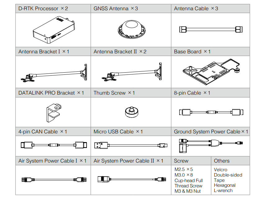

Description
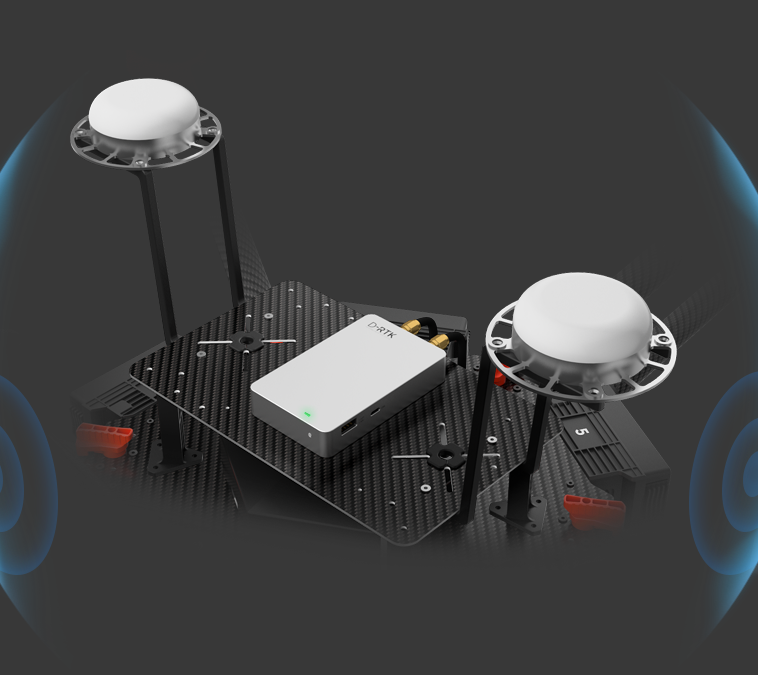
DJI D-RTK is high precision navigation and positioning system specially designed for DJI A3 series flight controllers. Using dynamic differential technology, it provides ultra-accurate, centimeter-level 3D positioning. This enhanced accuracy over typical barometer, compass, and GPS systems makes D-RTK essential for commercial, industrial, and scientific applications where accuracy is imperative.
Precise positioning of one centimeter vertically and horizontally is made possible through dynamic differential technology. This extreme accuracy allows for the creation of repeatable flight routes that provide reliable and valuable visual data essential for commercial and industrial scenarios.
Barometers commonly found in UAS systems may suffer from altitude discrepancies when faced with fluctuations in airflow, such as during takeoff, under braking, or after extended flying. This affects an aircraft’s flight and introduces unwanted data variation that complicates workflows. DJI D-RTK’s precision altitudinal calculations reduce variation to one centimeter, effectively eliminating variations, giving professionals data they can rely on.
Dual antennas create heading references that are significantly more accurate than possible with a single compass sensor. By removing compass dependence, the system is also resistant to magnetic interference, such as those generated by metal structures and high voltage power lines, allowing for accurate flight in environments where other aircraft cannot function.
Specifically designed to work with the A3 series flight controllers over DATALINK PRO wireless transmission links, D-RTK provides a comprehensive solution for a variety of industries. Support for DJI GO and DJI Assistant 2 allows seamless connection to a Ground Station Pro* for accurate, repeatable flight paths ideal for surveying, agriculture and aerial inspection.*With A3 & LB2
Specification for DJI D-RTK
| Positioning Accuracy | Horizontal: 1 cm + 1 ppm Vertical: 2 cm + 1 ppm |
|---|---|
| Orientation Accuracy | (0.2/R)° R is the baseline distance (distance between the two Air System antennas) in meters. |
| Root Mean Square (RMS) | 0.03 m/s |
| Frequency Used | Global version: GPS L1&L2, GLONASS F1&F2 Asia-Pacific Version: GPS L1&L2, BEIDOU B1&B2 |
| Interface Type | CAN, UART, USB |
| Input Voltage | 3S to 12S (12 to 52 V) |
| Power Consumption | 5.2 W |
| Current | 0.45 A (@ 12 V) |
| D-RTK Processor Dimensions | 112.3 mm × 63 mm × 18.6 mm |
| D-RTK Processor Weight | 139.5 g |
| Operating Temperature | 32° to 113°F (0° to 45°C) |
| Storage Temperature | -40° to 185°F (-40° to 85°C) |