
Description
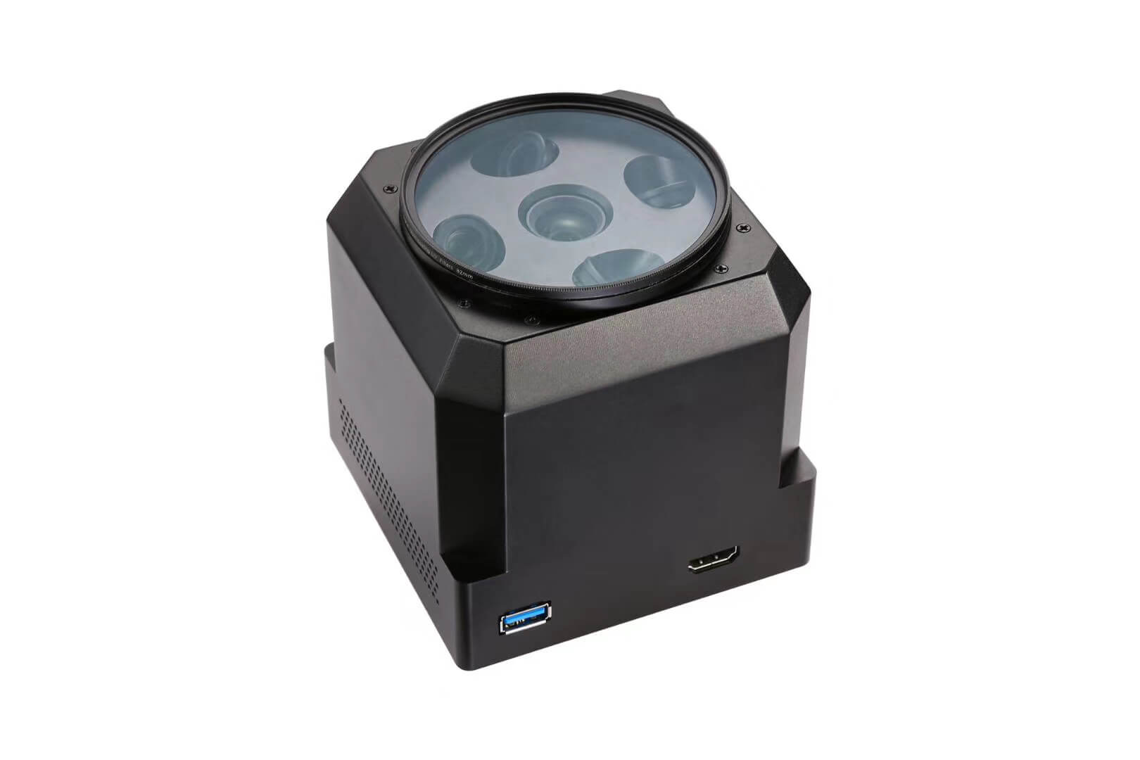
Aerial oblique photography 5 CCD mapping cameras for DJI Matrice 300 RTK -DJI M300 RTK drone. develop on DJI payload SDK, seamlessly compatible with DJI Matrice 200 and DJI Matrice 300 RTK, powered by DJI Skyport . with the lasted DJI industrial drone platform, the 5 CCD oblique photography mapping camera can meet the accuracy of 1:500 3D mapping & survey, high efficient mapping solution.
DJI M300 RTK is the latest DJI powerful industrial level drone, Max 55 mins flight time, 15KM Transmission Range, Max Speed 23m/s, 6-way to intelligent avoidance, it is the best 3D oblique photography mapping drone platform, powerful, smart, accurate and high efficiency.
The DJI M300 RTK has six-way positioning and obstacle avoidance ability of binocular vision and infrared sensor fusion, the high-level waterproof performance of IP45, Maneuverability under various ultra-high-speed flights such as ascent, descent, and tilt flight, professional aviation-level flight assistance interface, advanced dual control, enhanced team collaboration. Multiple redundant systems, ultra-high reliability, unprecedented development ecological support, Industry data transmission, real-time and efficient.
The Feature of Aerial oblique photography 5 CCD mapping camera.
- High efficiency
The oblique photography photo has a ground resolution of 1.5cm, flight speed of 12m/s, and a single-frame coverage area of 0.68km², allowing you to double your field survey efficiency. - 2. Free phase control
The first domestic tilt-camera image-free control to achieve integrated high-precision measurement of the farmhouse, real-time differential positioning of the network RTK, no post-resolving operation, five cameras independently collect and record POS data, the data is accurate to 1cm, farewell to the aerial survey image control point. - 3. High standards
The five CCD cameras are shipped with dual (indoor/outdoor) precision surveying and mapping calibration, calibration and calculation to verify that the camera distortion parameters meet the requirements of phase-free surveying and mapping. - Large storage
The entire system has 640GB of memory space and mass storage, allowing you to fly all day long. - High integration
There is no need for accessories for parameter adjustment, storage, and parameter display. It is integrated into one device, which is very simple and convenient.
Real-time dual image transmission: M300 drone and camera take dual image transmission, ground real-time synchronous flight picture, dynamic and static dual screen, giving you the most real control experience.
High-definition OLED display: The camera’s independent high-definition display, for the first time, realizes the camera ID, number of photos, camera status, body temperature, RTK signal, control information, and all camera information is visible on one screen.
Lightweight fuselage, newly upgraded CNC alloy shell, self-test after power-on, intelligent heat dissipation, and guarantee the best performance of aerial survey in the whole process. - Fully compatible.
It can be deeply compatible with the DJI terra and complete one-click high-precision three-dimensional modeling with one click.
Specification of DJI M300 RTK oblique photography Mapping camera;
| Size | 140x140x80 mm |
| Weight | 650g |
| CCD Camera | 5 |
| Lens Focus | 35mm |
| Pixels | Total 120 mp single camera 24mp |
| angle | 45° |
| Sensor size | APS-C (23.5×15.6mm) |
| Pixel size | 3.9 um |
| Image format | 6000X4000 |
| Exposure method | Flight control trigger exposure |
| Exposure time | ≥0.8 s |
| storage | 640GB |
| Camera powered | DJI Skyport |
| Switch state | Automatic switch |
| Data reading | Type-C interface unified reading |
| working environment | -10°C – 50°C |
| Operating temperature | humidity 95% |