

The regular inspection of the powerline can effectively eliminate potential hidden dangers or losses and ensure the safe operation of the power line. However, the manual powerline inspection has high labor intensity and low efficiency, and there is danger in the inspection work of the high-voltage power line, and there is no any good solution for the power line that passes through the barren hills and deep valleys. At this time, the airborne Lidar came in handy and showed its talents. In recent years, it has been gradually accepted and promoted by the power industry. What is the Drone Lidar? What is the working principle and process of drone with lidar powerline inspection? In which areas can you play a role?
What is a Lidar?
Lidar, Light Detection And Ranging (LiDAR), which combines laser detection and ranging, combines laser technology with modern photodetection technology, uses laser as the emission source, and transmits high-frequency laser pulses to the detection target to obtain the spatial position of the target. . Lidar systems typically integrate laser ranging technology, global positioning technology (GPS), and inertial measurement technology (IMU) to capture the three-dimensional spatial information of the target directly, quickly, actively, and accurately, with high data density and resolution. high. Based on these data acquisition advantages, lidar and imaging spectroscopy, imaging radar technology are listed as three cutting-edge technologies in the field of Earth observation.
Lidar can be divided into spaceborne, airborne and ground-based laser radars according to the platform.
Spaceborne Lidar is mainly used in aerospace and scientific experiments. For example, NASA launched the GLAS (Geoscience Laser Altimeter System) on the ICESat-1 satellite in 2003, and the laser altimeter mounted on the Chang’e-1 in 2007.
Ground-based lidar is mainly used for three-dimensional fine modeling of features, suitable for small-scale applications.
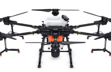
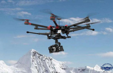
Airborne laser radar uses UAV, helicopter and other platforms as the platform. The high-frequency laser pulse has certain penetrability. It can penetrate the dense vegetation canopy and obtain the understory information of the forest. It is very suitable for narrow areas, vegetation coverage and complex terrain. The acquisition of three-dimensional information provides strong technical support for digital power grid construction and line safety inspection. Its application can cover the previous grid route planning, survey, design and construction, and even later digital management, security operation and maintenance. .
Let’s take a look at how airborne Lidar provides technical support for digital power line construction and transmission line safety inspection.
What is the working principle and process of Lidar?
Taking the research results of Wang Cheng, a team of researchers from the Institute of Remote Sensing and Digital Earth of the Chinese Academy of Sciences as an example, we show the application of airborne lidar in digital power grid construction and transmission line safety inspection, and introduce the first free laser developed by the team. The power inspection module in the radar point cloud data processing software “Point Cloud Rubik’s Cube”.
- Working principle of airborne Lidar
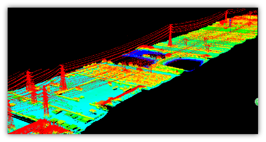
The working mode and principle of airborne Lidar (Fig. 1), that is, the laser ranging system actively emits high-frequency laser pulses to the detection target, and directly obtains the distance, slope, roughness and reflectivity of the surface of the ground object. Processing generates high-density three-dimensional space coordinates, ie point clouds. Each point of the laser point cloud data not only has x, y plane coordinate information, but also has elevation information, that is, z value, and can also display and measure these point clouds from different perspectives, and calculate the target expressed by the point cloud. Surface area, volume, etc., which is the biggest advantage of laser radar from traditional optical remote sensing and microwave remote sensing data. Figure 2 shows the original laser point cloud data for a high-voltage transmission line corridor.
You must be logged in to post a comment.