
First: stack measurement
The scope of application of stack measurement is very wide. The measurement of mound sand piles in mines, thermal power plants, construction projects, bulk cargo estimation at port terminals, and grain pile estimation in granaries are all inseparable from stack measurement. technology.
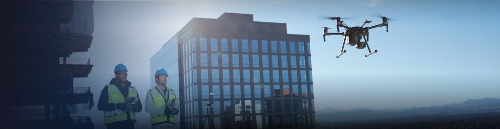
At present, the measurement of the pile body mainly relies on the total station instrument, the disk coal meter, the GPS and other measuring instruments to measure the pile body. Compared with the measurement of the manual use of the tape measure earlier, these measurement methods have made great progress. However, today there are more efficient and accurate measurement methods: using drone mapping and modeling.
The drone can preset the route and collect data automatically in the work area. After the data is collected, it can be imported into the GIS system independently developed by the Kaifei application, and generate the point cloud and 3D model data in one click, and then calculate the spatial distance and volume according to this. The measurement, or the simulation measurement of irregular stack area such as bevel, provides accurate numerical reference for engineering construction planning and production operations.
2
Tunnel monitoring
The traditional subway, railway and automobile tunnel inspection requires the inspectors to go inside the tunnel and use manual inspection to confirm whether there are any abnormalities such as cracks or water leakage, and to ensure that there is no problem with the tunnel structure.
This method relies too much on manpower, is inefficient and has certain security risks. The subway, railway and automobile tunnels as traffic passages have very limited time for the inspection personnel, which further increases the difficulty of inspection.
UAVs equipped with high-definition cameras and laser radar and other detection equipment can collect high-precision image data in the tunnel and generate 3D models for viewing at any time. This not only provides higher inspection accuracy, but also allows engineers to have More time is focused on analyzing the data collected and quickly suggesting the countermeasures that need to be taken.
3
Highway surveying and mapping
For the maintenance and reconstruction of large-scale transportation infrastructure such as highways, the first step is to obtain clear image data of all road conditions.
This large task used to require manual or helicopter work to complete. Manual inspections take too long, and the cost of helicopter inspections is too high. In comparison, drones have many advantages such as low cost, high efficiency, high precision, etc., and are the best choice for road surveying and mapping.
The UAV mapping system for Qifei application integrates the UAV (fixed wing/multi-rotor), 3D modeling software and GIS application, and cooperates with the powerful workstation of Qifei application to complete the surveying and mapping work efficiently. It is also possible to accurately evaluate the engineering quantity of the road reconstruction through the GIS application software of the Kaifei application, and simulate the scene effects and possible surrounding environmental impacts after the engineering transformation, and provide strong support for the road reconstruction and road planning work of the highway department.
4:
Bridge inspection
Bridge inspection is mainly to check and evaluate its appearance and structural performance. Usually, the performance of the structure is checked through a series of mechanical tests, and the inspection of its appearance mainly depends on the naked eye or auxiliary tools (such as bridge inspection vehicles, telescopes, etc.). ) to detect whether the main components of the bridge are cracked, cracked, cracked, rusted, and vacant.
Traditional bridge testing mostly uses relevant special instruments to measure, record and count all parts of the bridge. In this process, maintenance personnel need to hang under the bridge or start testing from the elevated platform. For special structural bridges (such as cable-stayed bridges, suspension bridges, concrete-filled steel tube arches, etc.) or large-span high-rise bridges, traditional inspection tools can hardly come in handy and can only be returned to the original form of manual inspection.
Manual inspection operations are not only inefficient, difficult, and have high risk factors, but the detection accuracy is far from enough, and the application of drone technology will solve this problem to a large extent.
The drone can complete the photographing and forensics of the structural planes such as the bottom surface of the bridge, the cylinder surface and the beam through the control devices such as cameras and laser radars. At the same time, the three-dimensional modeling of the bridge as a whole can be carried out, and the external structure of the bridge can be measured by the model for professional The personnel analyze the state of the bridge and discover the danger in time, which can greatly reduce the work intensity of the bridge maintenance personnel and improve the efficiency of bridge inspection and maintenance.
5:
Cultural relic protection
Cultural relics are relics and relics left by human beings in the course of historical development. It is a precious historical and cultural heritage of mankind. In the field of cultural relics protection, 3D scanning technology is more efficient and accurate than traditional manual measurement, and the non-contact specificity will not cause damage to cultural relics.
For large ancient villages, we can use the drone system to quickly complete a wide range of data collection; the unmanned aerial vehicle can be equipped with laser radar to collect image data of monuments, obtain point cloud of cultural relics for accurate reconstruction, and establish From the physical three-dimensional or model database, preserve the important resources such as the original type data and spatial relationship of the cultural relics, realize the scientific, high-precision and permanent preservation of the endangered cultural relics resources, and then establish a VR digital museum that can be browsed online;
6: Archaeological restoration
UAV 3D modeling technology can also be used for archaeological and cultural relics restoration. 3D scanning technology uses surface data acquisition to replace traditional point data acquisition. High-speed laser measurement method can quickly, accurately and comprehensively acquire 3D information of objects. Really record the real three-dimensional information of cultural relics, establish a three-dimensional model, and transform from traditional manual measurement to high-precision measurement of point cloud data by indoor computer. It has non-contact property and avoids damage to cultural relics.
Some large-scale cultural relics are up to tens of meters, which is not only difficult to record, but also difficult to record for complex patterns and key parts. It is very difficult for traditional surveying, but it can accurately reflect spatial position by using 3D panoramic scanning. High-density point clouds with color values enable information visualization. These techniques can be used to improve the accuracy and pre-judgment of cultural relics, to select the protection methods to be used, and to shorten the repair period;
7: Land Determination
The traditional land determination measurement work is generally carried out by measuring the topographic map by ground engineering measurement or by aerial surveying the topographic map of a traditional manned aircraft. Compared with the traditional method, the use of drones for aerial photogrammetry has obvious advantages, low cost, easy implementation, high degree of automation, high efficiency and high precision.
Therefore, in the rural collective land registration and certification work, it is a feasible way to obtain the basic topographic map data through UAV aerial photography modeling. The UAV application of the Qifei application is equipped with a five-lens camera, which can collect data and capture images of large areas of land within the rural collective land, obtain high-precision three-dimensional data of the surface, and then carry out rapid three-dimensional construction through the side view image of collaborative operation. Modeling, drawing a topographic map with a large scale, assisting the registration and certification of rural collective land ownership rights to proceed smoothly.
8: Real estate registration
As an auxiliary means, UAVs help real estate registrants to greatly improve efficiency and save money in field investigations and audits. The application of UAV aerial mapping technology can make the registration of ownership registration more accurate and avoid registration errors and risks to the greatest extent. On the other hand, the GIS system and data established by UAV aerial survey are directly used for unified registration of real estate. It can save a lot of expensive and time-consuming data production and finishing costs. The GIS smart city system that launches the application can be fully integrated with the existing real estate registration data, thereby realizing the digitization, precision and real-time of the entire real estate registration and management.
")


You must be logged in to post a comment.