
Natural or man made disasters create severe challenges for both emergency services and first responders. Areas with no roads and environmental challenges can appear insurmountable yet drone are capable of providing mapping, terrain data, act as radio relays and provide critical payload delivery. UAV are now play a more important role on disaster relief and emergency search & rescue fields.
At 22:55 on June 17th, a magnitude 6.0 earthquake occurred in Changning County, Yibin City, Sichuan Province. After the disaster occurred, DJI Enterprise applied the first time to set up an emergency drone response project team. After getting in touch with the emergency management and fire rescue department of Sichuan Province, DJI enterprise applied resources to coordinate resources nearby, and set up an emergency support team with partners to rush to the earthquake zone to assist in rescue.
In the following 26 hours, the DJI Emergency Support Team flew more than 40 drones on site, generating one high-resolution and low-precision two-dimensional orthophoto images in the disaster area, providing on-site video support for more than 4 hours. The on-site rescue assistance task assigned by the emergency management and fire rescue department was completed.
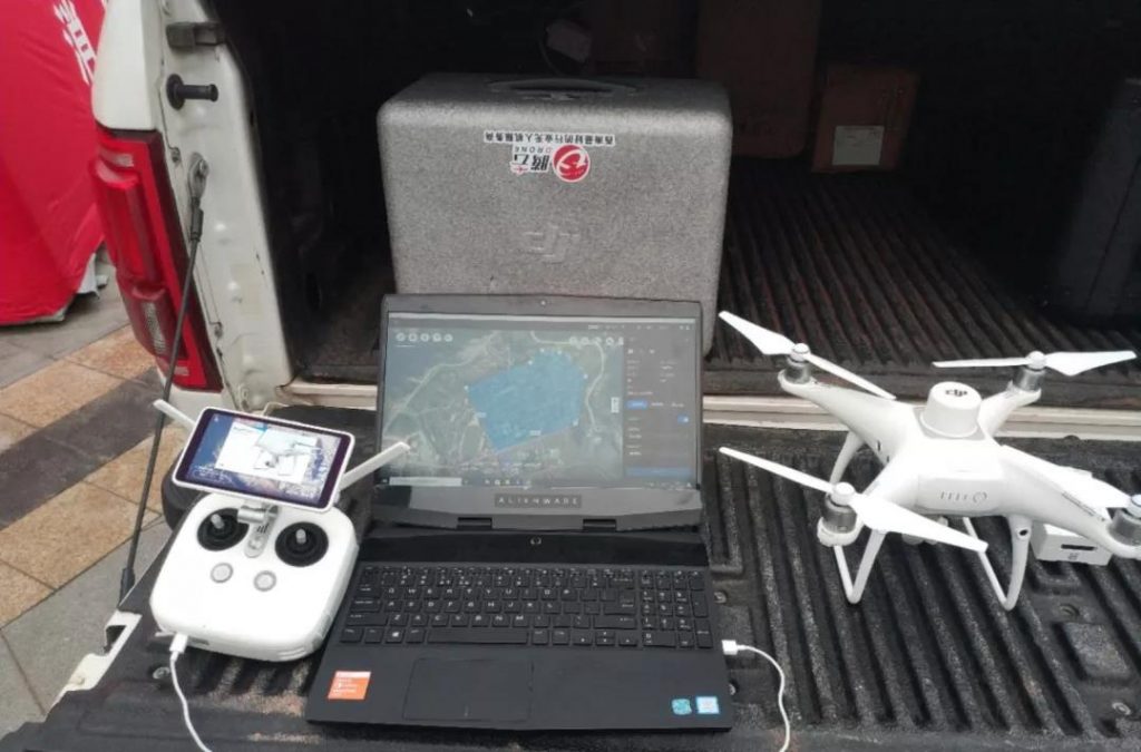
Emergency aerial Device
Through communication with the Sichuan Provincial Emergency Rescue Department, the DJI Enterprise Industry Application Emergency Response Project Team conducted a preliminary assessment of the site disaster and confirmed the following equipment:
2X DJI Matrice M210 V2 Drone
2 X DJI Phantom 4 RTK Drone
2 X DJI Phantom 4 Pro Drone
1X Mavic 2 industry dual version Drone
1 X Mavic 2 Professional
1 X Zenmuse XT2 thermal imaging camera
1 X Zenmuse Z30 30X optical camera
High performance notebook
Enough battery and charging equipment
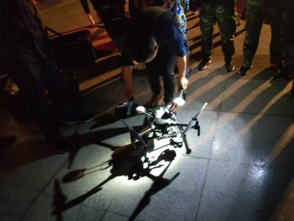
DJI Matrice M210 V2 drone has an automatic obstacle avoidance and dual battery system, and it can provide continuous and effective support for rescue work in a complex environment by carrying a rich load.
The Phantom 4 RTK drone with DJI Terra will open the link of route planning, data acquisition, model reconstruction and data analysis, and quickly acquire the 2D/3D model of the seismic core area to provide critical data support for the on-site rescue command.
The “Mavic” 2 Entreprise version is lightweight and portable, can be carried by a single person, has omnidirectional sensing and intelligent obstacle avoidance, can record multi-dimensional information in the complex environment after the earthquake, providing timely decision support and comprehensive data.
Zenmuse XT2 supports superimposed supervised and infrared thermal imaging images. The Z30 supports 30x optical zoom, which can detect subtle problems of the ground from a high-altitude perspective and better fulfill the live video support task.
Emergency rescue workflow
1:Docking rescue department, forming emergency team
2:Digital aerial survey to collect live images from disaster areas
Phantom 4 RTK real-time generation of 2D orthophotos of seismic centerAt 8:00 on June 18, DJI Emergency Support Team began to collect 2D image data from the earthquake center area.
Firstly, a large-scale preliminary observation of the disaster area was carried out using the M210 V2 mounted zenith Z30 camera, and the relative offset of the satellite map and the actual terrain was determined by manual flight multi-point positioning to ensure accurate and effective route planning.
Next, use DJI Terra to plan the route of the work area and upload it to the wizard Phantom 4 RTK to automatically complete the image acquisition. Synchronous positioning, map construction and image ortho-correction algorithm of DJI Terra can synchronously generate 2D orthophotos according to the high-definition images transmitted in real time during the flight process of drones.
At 8:20, the DJI support team returned the first 2D orthophoto image with a ground resolution of 6cm/pixel to the emergency management and fire rescue department in the earthquake zone, providing data for the previous site command.
At 11 o’clock, Dajiang Terra generated a second 2D orthophoto with a ground resolution of 3cm/pixel, which provided the command center with information on the latitude and longitude coordinates, distance and area of the important area. The digital security command and rescue work was steadily advanced.
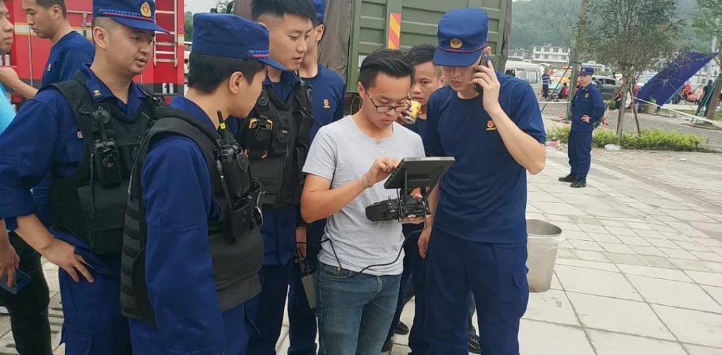
3:Live video to get real-time picture of the core area
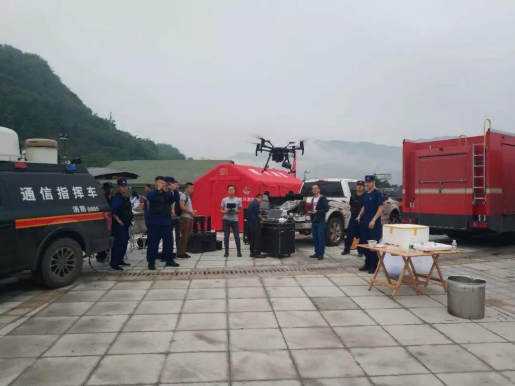
Synchronized with the 2D data acquisition work, DJI Emergency Support Team uses the Phantom 4 Pro, Matrice M210 V2 drone, and Mavic 2 Professional drone to perform uninterrupted video image capture at multiple points above the core of the earthquake zone. The number of man-machines is 40, providing video security for more than 4 hours, and accessing the fire command system through the output HDMI video stream to provide multiple real-time aerial images for the command center and field commanders.
4: Drone 3D model reconstruction, Research & analysis data supporting after the disaster.
On the afternoon of June 18th, DJI Emergency Support Team carried out 3D model data collection in the earthquake center area. Through high-precision 3D model, relevant departments can directly perform latitude and longitude coordinate labeling, linear distance, area and volume measurement on the model. Provide important data support for disaster investigation and after-disaster disposal.
Intelligent decision making, efficient disaster relief
In the past emergency rescue work, the lack of effective topographic data for reference is one of the pain points of on-site emergency command. In the case of heavy and geological disasters, the commander often takes about a week to obtain satellite maps of the disaster area, which seriously affects the efficiency of post-disaster rescue.
With the advantages of simple take-off and landing, convenient carrying, reliable performance and diverse viewing angles, the multi-rotor UAV drone can acquire the aerial aerial scene of the disaster area in the first time after the disaster and generate real-time 2D orthophoto images in real time, providing a reliable basis for the rescue command. Moreover, with the development of the supporting software for the drone, the efficiency of the on-site modeling of the UAV has been improved. For example, DJI Terra has opened up the three parts of the route planning, data acquisition and transmission, and image processing in the traditional modeling process. The output efficiency of the 2D/3D model in the disaster area has been greatly improved, and it can provide a rich data basis for disaster relief command.
At present, DJI industry application has established an emergency response mechanism for heavy and extraordinary events, hoping to assist in post-disaster relief by providing professional multi-rotor UAV equipment, emergency support personnel and related resources in the face of major disasters. . In the future, DJI industry application will continue to develop the functions of emergency rescue on the hardware and software platforms of drones, and provide better support for disaster relief.

You must be logged in to post a comment.