

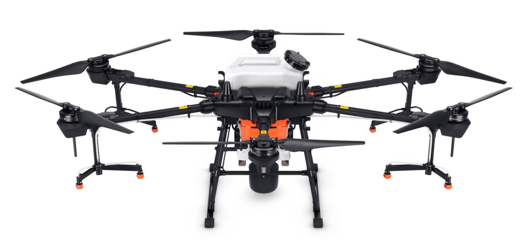
DJI Agras T30 Price and specs
Friday, 13 August 2021
The DJI T30 is the biggest agriculture spraying drone that DJI has released till now, we can supply the T30 now, ship to worldwide at a very good price, the specs are very detailed here below, With a 30-liter spraying tank, the DJI Agras T30 takes aerial spraying efficiency to new heights. A revolutionary transforming
- Published in Uncategorized
Optical fiber tethered drone system solution
Tuesday, 10 August 2021
Our company developed different types of tethered drone systems, the tethered system length from 50M-200M height, the payload from 5Kg to 50Kg, Heavy load tether system meet different application, also the optical fiber cable tethered system, that can transfer the data and video link via the fiber cable from the air units to the ground
- Published in Technology

Drone Hyperspectral camera sample & application
Thursday, 24 June 2021
This is some of the Hyperspectral camera application that in different fields. 1:Using hyperspectral technology to study the progress of river water quality, selecting a classic model that monitors the concentration and turbidity of suspended solids, using a drone equipped with a hyperspectral camera to obtain river image data in Zhongshan City, and then inverting
- Published in Technology

Tethered Drone for outdoor emergency lighting
Thursday, 27 May 2021
In the face of emergency rescue and emergency response at night, ensuring outdoor lighting is an important part of rescue operations. At present, all kinds of lighting equipment do not meet the requirements of fast response, flexible deployment, large range, high brightness, and strong environmental adaptability. The lighting problem of night rescue has become a
- Published in Technology

Drone (UAVs) based ambient air quality monitoring
Friday, 21 May 2021
Traditional air monitoring methods usually only provide air pollution data with cities or urban areas as boundaries, and cannot reflect the distribution characteristics and differences of air pollution in a small area, the lack of this information directly restricts local environmental protection departments, enterprises, and individuals from making the fastest, effective, and healthy decisions. Drone-based
- Published in Technology

Solar Blind UV Camera Sensor for Powerlinene corona discharge detection
Sunday, 16 May 2021
At present, the high-voltage powerline inspections mainly include infrared thermal imaging detection, ultrasonic corona detection, and manual visual inspection. The effect of infrared therm imaging detection is greatly affected by sunlight, atmospheric environment, etc., usually only at night, and only the more severely damaged parts can be detected; the inspection error is large, and the
- Published in Technology
Tethered Done systems for emergency outdoor lighting
Tuesday, 01 December 2020
We are a professional supplier & manufacturer for tethered drone systems, from 2.5KW-10KW tethered power system, 50M-150M length tethered cable, supporting 2Kg-15Kg payload UAVs platform. 1: What is a tethered drone ? There are 3 parts of a tethered drone; the ground power station,the air power units that mount to the drone, the tethered cable
- Published in Drone New
DJI Agras T20 Price and Specs
Thursday, 26 November 2020
The DJI Release its new agriculture spraying drone, DJI Agras T20, it is a powerful and smart 20L agriculture sprayer drone, let us introduce the price of DJI Agras T20 and its specification, features. With its powerful performance and outstanding spraying capabilities, the DJI Agras T20 is capable of autonomous operations over a variety of
- Published in Technology

Drone Laser Methane gas leak detection
Tuesday, 15 September 2020
In the natural gas, oil refineries, and chemical plants industries, methane gas leak away is high-risk events, the pipeline inspection is an effective way to find leaks, especially by using a drone, drone-mounted a remote methane leak detector, the drone laser Methane gas leak detector can efficiency and high accuracy to do this work. Natural
- Published in Technology

Ultraviolet rays UV drone camera for powerline Corona discharge detection
Friday, 28 August 2020
Corona discharge detection is a key part of the power inspection. The corona discharge detection equipment currently mainly includes infrared thermal imagers and ultraviolet cameras. The accuracy of infrared thermal imaging technology is not good. Due to daylight interference, background noise during the detection process Large, affect the detection accuracy, and when it detects heating,
- Published in Technology